Sunday, 16 August 2020

ആമസോൺ /ഫ്ലിപ്കാർട്ട് വഴി പണം സമ്പാദിക്കാം | അഫിലിയേറ്റ് മാർക്കറ്റിംഗ് വഴി


നിങ്ങൾ പല പ്രമുഖ യൂട്യൂബേഴ്സിന്റെയും റിവ്യൂ വീഡിയോകളിൽ അവർ റിവ്യൂ ചെയ്ത പ്രൊഡക്ടിന്റെ ആമസോൺ/ഫ്ലിപ്കാർട്ട് ലിങ്ക് ഡിസ്ക്രിപ്ഷൻ ബോക്സിൽ കൊടുത്തിരിക്കുന്നത് ശ്രദ്ധിച്ചിട്ടുണ്ടാവും. സാധാരണ ആളുകൾ  കോപ്പി ചെയ്യുമ്പോൾ ലഭിക്കുന്നതിനേക്കാൾ വ്യത്യസ്തമായ ലിങ്കാണ് അവർ നൽകുന്നത്.

എന്താണ് അവർക്ക് മാത്രം പ്രേത്യേകതയുള്ള ലിങ്ക് എന്ന് ചിന്തിച്ചിട്ടുണ്ടോ? 

ഉത്തരം സിമ്പിൾ,  അഫിലിയേറ്റ് ലിങ്ക് !! എന്താണെന്നല്ലേ..

ആമസോൺ, ഫ്ലിപ്കാർട്ട് പോലുള്ള ഇ-കോമേഴ്‌സ് സ്ഥാപനങ്ങൾ വഴി വിൽക്കുന്ന ഉത്പന്നങ്ങൾ  അത് ഏതുമാവട്ടെ, തങ്ങളുടെ രീതിയിൽ മാർക്കറ്റിംഗ് ചെയ്ത കൂടുതൽ ആളുകളെ കൊണ്ട് വാങ്ങിപ്പിച്ച് കമ്മീഷൻ നേടുന്ന രീതിയാണിത്. 

ഉദാഹരണത്തിന് നിങ്ങളുടെ സുഹൃത്ത് ഓൺലൈനായി ഒരു മൊബൈൽ ഫോൺ വാങ്ങാൻ ഉദ്ദേശിക്കുന്നു എന്ന് കരുതുക. നിങ്ങളുടെ ഫ്ലിപ്കാർട്ട്/ആമസോൺ അഫിലിയേറ്റ് ലിങ്ക് വഴി ആ സെയിം പ്രോഡക്റ്റ് സുഹൃത്തിനെ കൊണ്ട് വാങ്ങിപ്പിച്ചാൽ നിങ്ങൾക്ക് ഫോണിന്റെ കമ്മീഷൻ  ലഭിക്കുന്നു. ആമസോൺ അല്ലെങ്കിൽ ഫ്ലിപ്കാർട്ടിൽ ഉള്ള A-Z പ്രൊഡക്റ്റുകൾ കസ്റ്റം അഫ്‌ലിയേറ്റ് ഉപയോഗിച്ച് വിറ്റു കമ്മീഷൻ വാങ്ങാം. കമ്മീഷൻ തുക നേരിട്ട് എല്ലാ മാസവും നിങ്ങളുടെ അക്കൗണ്ടിലേക്ക് എത്തുന്നു. 

ഇൻസ്റ്റാഗ്രാം, ഫേസ്ബുക്ക്, വാട്സാപ്പ് പോലുള്ള സോഷ്യൽ മീഡിയ പ്ലാറ്റുഫോമുകളുടെ സാദ്ധ്യതകൾ  ഉപയോഗപ്പെടുത്തി മാസവും ഇതിൽ നിന്ന് നല്ല രീതിയിൽ വരുമാനം ഉണ്ടാകാൻ സാധിക്കുന്നതാണ്. 

✍️Amaldas Karakkattil

കൂടുതൽ വിവരങ്ങൾക്ക് താഴെ ഉള്ള ലിങ്കുകൾ പരിശോധിക്കുക 


Thursday, 2 April 2020

ഈസ്റ്റർ ദ്വീപും മോവായികൾ എന്ന അത്ഭുതവും !!

പസഫിക്കിൽ, പോളിനേഷ്യൻ ത്രികോണത്തിന്റെ തെക്കുകിഴക്കൻ അറ്റത്തായി സ്ഥിതിചെയ്യുന്ന ഒരു പോളിനേഷ്യൻ ദ്വീപാണ്‌ ഈസ്റ്റർ ദ്വീപ് (ഇംഗ്ലീഷ്:Easter Island). 1722ലെ ഈസ്റ്റര്‍ ദിനത്തില്‍ ഡച്ച് നാവികന്‍ ജേക്കബ് റഗോവീനാണ് ഈ ദ്വീപ് കണ്ടെത്തി പ്രശസ്തമാക്കിയത്. (അതിനു മുന്‍പു ചില നാവികര്‍ ദ്വീപ് കണ്ടെത്തിയെങ്കിലും, ദ്വീപിനെക്കുറിച്ചു യൂറോപ്യന്‍ രാജ്യങ്ങളില്‍ വ്യക്തമായ അറിവു ലഭിച്ചതു റഗോവീനില്‍ നിന്നാണ്). ഈസ്റ്റര്‍ ദിനത്തില്‍ കണ്ടെത്തിയതിനാല്‍, ദ്വീപിന് ഈസ്റ്റര്‍ ദ്വീപെന്നു പേരു നല്‍കുകയായിരുന്നു. പാശ്ച് ഐലന്റ്(Paasch-Eyland) എന്നാണ്‌ അദ്ദേഹം പേര് വിളിച്ചത്(ഈസ്റ്റർ ഐലന്റിന്‌ പതിനെട്ടാം നൂറ്റാണ്ടിലെ ഡച്ച് പേര്‌). ഈ ദ്വീപിന്റെ ഔദ്യോഗിക സ്പാനിഷ് നാമമായ ഇസ്‌ല ഡി പാസ്ക്വ(Isla de Pascua) എന്നതിന്റെ അർത്ഥവും ‘ഈസ്റ്റർ ഐലന്റ്’ എന്നാണ്‌.അക്കാലത്തു ദ്വീപില്‍ 10,000നും 15,000നും ഇടയില്‍ റാപനുയി വംശജര്‍ അധിവസിച്ചിരുന്നെന്നാണു നരവംശ ശാസ്ത്രജ്ഞരുടെ കണക്ക്.പോളിനേഷ്യന്‍ വംശജരാണു ദ്വീപില്‍ അധിവസിച്ച റാപനുയികള്‍ എന്നു കരുതപ്പെടുന്നു. 

മധ്യ-ദക്ഷിണ പസഫിക് സമുദ്രത്തില്‍ ചിതറിക്കിടക്കുന്ന ആയിരത്തിലധികം ദ്വീപുകളില്‍ അധിവസിക്കുന്നവരാണു പോളിനേഷ്യന്‍ വംശജര്‍. തൊട്ടടുത്ത പോളിനേഷ്യന്‍ അധിവാസ കേന്ദ്രത്തില്‍ നിന്ന് ഈസ്റ്റര്‍ ദ്വീപിലേക്ക് 1,500ലധികം കിലോമീറ്ററുകളുടെ അകലമുണ്ട്. എഡി നാലാം നൂറ്റാണ്ടിനും ഏഴാം നൂറ്റാണ്ടിനും ഇടയിലാകും ഈ ദ്വീപിലേക്കു മനുഷ്യര്‍ കുടിയേറിയതെന്നു കരുതപ്പെടുന്നു.
വന്‍ വൃക്ഷങ്ങളൊന്നും ഇല്ല എന്നതാണ് ദ്വീപിന്‍റെ മറ്റൊരു പ്രത്യേകത. പണ്ട് കാലത്ത് പതിനയ്യായിരത്തിലേറെ റാപനൂയി വംശജര്‍ ദ്വീപില്‍ അതിവസിച്ചിരുന്നു എന്ന് കരുതപ്പെടുന്നു. അന്ന് അവര്‍ വെട്ടി നശിപ്പിച്ചത് കൊണ്ടാകാം ദ്വീപില്‍ വന്‍ വൃക്ഷങ്ങളൊന്നും അവശേഷിക്കാത്തതെന്ന് ശാസ്ത്രജ്ഞര്‍ പറയുന്നു. ഇപ്പോള്‍ ചിലിയുടെ അധീനതയിലുള്ള ദ്വീപില്‍ കഷ്ടിച്ച് നാലായിരമാണ് ജനസംഖ്യ. പത്തൊമ്പതാം നൂറ്റാണ്ടിന്‍റെ തുടക്കത്തില്‍ ദ്വീപില്‍ പകര്‍ച്ച വ്യാധികള്‍ പടര്‍ന്നു പിടിച്ചതും അടിമക്കച്ചവടവും കാരണമാണ് ദ്വീപിലെ ജനസംഖ്യ കുത്തനെ കുറയാന്‍ കാരണമായി.ദ്വീപിലെ വിഭവങ്ങളുടെ അമിത ചൂഷണം കാരണം കാലാന്തരത്തിൽ ഈ ദ്വീപിലെ ആവാസവ്യവസ്ഥക്ക് കനത്ത തകർച്ച നേരിടേണ്ടി വരികയും അത് ചരിത്രാതീതകാലത്തെ നിരവധി ജീവിവർഗ്ഗങ്ങൾ വംശനാശം സംഭവിക്കാൻ ഇടവരുത്തുകയും ചെയ്തു.
റാപനുയി വംശജരാണ് ഈസ്റ്റര്‍ ദ്വീപിലെ ആദിവാസികള്‍. 2002ല്‍ ദ്വീപിലെ ജനസംഖ്യ 3791. അവരില്‍ 60 ശതമാനം പേര്‍ റാപനുയി പാരമ്പര്യം അവകാശപ്പെടുന്നു. 1877ല്‍ ദ്വീപില്‍ 111 റാപനുയി വംശജര്‍ മാത്രമാണ് അവശേഷിച്ചിരുന്നത്. അവരില്‍ 36 പേര്‍ക്കു മാത്രമേ പിന്‍ഗാമികള്‍ ജനിച്ചുള്ളൂ. ഇപ്പോഴുള്ള ആദിവാസികള്‍ എല്ലാവരും ഈ 36 പേരുടെ പിന്‍തലമുറക്കാരാണ്. ആദ്യ കുടിയേറ്റക്കാരുടെയും പിന്നീട്‌ യൂറോപ്പ്, ചിലി തുടങ്ങിയ പ്രദേശങ്ങളിൽനിന്ന് എത്തിയവരുടെയും സങ്കര സന്താനങ്ങളാണ്‌ ഇപ്പോഴത്തെ ദ്വീപുവാസികൾ.

നിർജീവമായ മൂന്ന് അഗ്നിപർവതങ്ങൾ ഉൾപ്പെട്ടതാണ്‌ 166 ചതുരശ്ര കിലോമീറ്റർ വിസ്‌തീർണമുള്ള ഈ ത്രികോണ ദ്വീപ്‌.
ചിലിയൻ പോളിനേഷ്യൻ ദ്വീപുകളുടെ ഭാഗമായ ഈസ്റ്റർ ദ്വീപിൽ കാണപ്പെടുന്ന ഭീമാകാരന്മാരായ ഏകശിലാ പ്രതിമകളാണ്‌ മൊവായികൾ (Moai). ദ്വീപ്‌ നിവാസികളായിരുന്ന റാപാ നുയ്‌ വിഭാഗക്കാർ എ ഡി 1200 നും 1500 നും മധ്യെ നിർമ്മിച്ചവയായിരുന്നു ഈ പ്രതിമകൾ. സവിശേഷമായ രൂപഘടനയുള്ള ശിൽപ്പങ്ങളാണ്‌ മൊവായികൾ. വലിയ ശിരസ്സും കാതുകളുമുള്ള ഈ ശിൽപ്പങ്ങൾ നന്നേ ഭാരമേറിയവയായിരുന്നു. ആകെ വലിപ്പത്തിന്റെ എട്ടിൽ മൂന്നു ഭാഗം ശിരസ്സായിരുന്നു. ദ്വീപിൽ ഉള്ള പാറമടകളിൽ നിന്നും കൊത്തിയെടുക്കുന്ന ശിൽപ്പങ്ങൾ തീരത്തോട്‌ ചേർന്നുള്ള പ്രതിഷ്ഠാ പീഠങ്ങളിലേക്ക്‌ എങ്ങനെ എത്തിച്ചിരുന്നു എന്ന് ഇന്നും ഗവേഷകരെ കുഴക്കുന്ന ചോദ്യമാണ്‌. പൂർത്തീകരിച്ച മൊവായികളിൽ ഏറ്റവും ഉയരംകൂടിയ മൊവായിയായ 'പറൊ'യ്ക്ക്‌ പത്ത്‌ മീറ്റർ ഉയരവും (33 അടി) 82 ടൺ ഭാരവും ഉണ്ട്‌. ടണ്‍ കണക്കിനു ഭാരം വരുന്ന ശിലാ ശില്‍പ്പങ്ങള്‍ എങ്ങനെ മണ്ണില്‍ ഇളക്കം കട്ടാതെ ഉറപ്പിച്ചിരിക്കുന്നു എന്നതു പുരാവസ്തു ഗവേഷകരെ അത്ഭുതപ്പെടുത്തിയിരുന്നു. ബലമുള്ള അടിത്തറയിലാകും അവ ഉറപ്പിച്ചിരിക്കുന്നതെന്നായിരുന്നു നേരത്തെ കരുതപ്പെട്ടിരുന്നത്. എന്നാല്‍, ശിലാ ശിരസുകള്‍ക്ക് ഉടല്‍ ഉണ്ടാകുമെന്ന നിഗമനത്തില്‍ ഗവേഷകര്‍ പിന്നീട് എത്തിച്ചേര്‍ന്നു. ആ നിഗമനം ശരിയെന്ന് അടുത്തനാളില്‍ നടന്ന ഉല്‍ഖനനം തെളിയിച്ചു.   ഏഴു മീറ്റര്‍ ഉയരമുള്ള രണ്ടു ശിലാ ശിരസുകളാണു പഠന വിധേയമാക്കിയത്. ചുറ്റുമുള്ള മണ്ണുനീക്കം ചെയ്തപ്പോള്‍, ശിലാശിരസുകളുടെ കീഴില്‍ ഉടലുണ്ടെന്നു കണ്ടെത്തി.യുനെസ്‌കൊയുടെ ലോകപൈതൃക ഭൂപടത്തിൽ പെടുന്ന ഈ ദ്വീപ് റാപ നൂയി ദേശീയോദ്യാനത്തിന്റെ ഭാഗമായി സംരക്ഷിക്കപ്പെട്ടിരിക്കുന്നു. 


പരേതരോടുള്ള ആദരവ്‌ സൂചിപ്പിക്കാനോ, ദേവപ്രീതിയ്ക്കോ, ഗോത്രങ്ങൾ തമ്മിലുള്ള ബലാബലത്തിൽ അഭിമാനചിഹ്നങ്ങളായോ മറ്റോ  ഉപയോഗിക്കാനായിരുന്നിരിക്കണം മൊവായികൾ ഇവ നിർമ്മിച്ചത്‌. ഇവ ദ്വീപിന്റെ തീരങ്ങളിലേക്ക്‌ എത്തിക്കാൻ ഉപയോഗിച്ചിരുന്ന രീതിയെപ്പറ്റി നിരവധി വാദങ്ങളും വിശ്വാസങ്ങളും നിലവിലുണ്ട്‌. മാന്ത്രികവിദ്യ ഉപയോഗിച്ചും അഭൗമശക്തികളുടെ സഹായത്താലുമൊക്കെ ഇവ സ്ഥാപിച്ചതാകാമെന്നുമാണ്‌ പരമ്പരാഗത വിശ്വാസം. എന്നാൽ മരത്തടികളും കയറും മറ്റും ഉപയോഗിച്ച്‌, കുന്നിൻ ചെരിവിലൂടെ നിർമ്മിച്ച പ്രത്യേക പാതയിലൂടെ ഇവ സാവധാനം നീക്കിക്കൊണ്ടുവന്നു എന്നാണ്‌ ഗവേഷകർ അനുമാനിക്കുന്നത്‌. 

കടുത്ത വനനശീകരണവും ഗോത്രങ്ങൾ തമ്മിലുള്ള കലാപങ്ങളും കാരണം ദ്വീപുനിവാസികളിൽ ഭൂരിപക്ഷത്തിനും അതിജീവനം അസാധ്യമായതോടെ എ.ഡി 1600 ആയപ്പോഴേക്കും ദ്വീപ്‌ ഏറെക്കുറെ ഉപേക്ഷിക്കപ്പെട്ടു. ഇന്ന് യുനസ്കൊയുടെ ലോക പൈതൃക പട്ടികയിലുള്ള സംരക്ഷിത സ്മാരകമാണ്‌ ഈസ്റ്റർ ദ്വീപും മൊവായികളും.

Wednesday, 1 April 2020

നോബൽ തോൽപിച്ച മലയാളി ശാസ്ത്രജ്ഞൻ

ECG സുദർശൻ അഥവാ എണ്ണക്കൽ ചാണ്ടി ജോർജ് സുദർശൻ സൈദ്ധാന്തിക ഫിസിക്സിൽ അറിയപ്പെടുന്ന ഭാരതീയ ശാസ്ത്രജ്ഞനാണ്. യൂണിവേഴ്സിറ്റി ഓഫ് ടെക്സസിൽ പ്രഫസർ ആയിരുന്ന അദ്ദേഹം  സൈദ്ധാന്തിക ഫിസിക്സിൽ ഒട്ടനവധി സംഭാവനകൾ സമ്മാനിച്ചിട്ടുണ്ട്.കൂടാതെ ഒമ്പത് തവണ നോബൽ നാമനിർദേശം കിട്ടിയ ഭാരതീയനാണ് അദ്ദേഹം.

കേരളത്തിലെ കോട്ടയം ജില്ലയിലെ പള്ളം എന്ന സ്ഥലത്താണ് ECG സുദർശൻ ജനിച്ചത്. കോട്ടയം CMS കോളേജിലെ വിദ്യാഭ്യാസത്തിന് ശേഷം 1951-ൽ മദ്രാസ് ക്രിസ്ത്യൻ കോളജിൽ നിന്ന് ബിഎസ്‌സി (ഓണേഴ്സ്) ബിരുദം നേടി.1952 -55 കാലഘട്ടത്തിൽ  മുംബൈ ടാറ്റ ഇൻസ്റ്റിറ്റ്യൂട്ട് ഓഫ് ഫണ്ടമെന്റൽ റിസർച്ചിൽ റിസർച് അസിസ്റ്റന്റ് ആയി ചേർന്നു. 1958 ൽ  ന്യൂയോർക്കിലെ റോച്ചസ്റ്റർ സർവകലാശാലയിൽനിന്നു പിഎച്ച്ഡി നേടിയ അദ്ദേഹം അമേരിക്കയിൽ സ്ഥിരതാമസക്കാരാനായി. പിന്നീട് ഹാർ‌‌വഡ് സർവകലാശാല, റോച്ചസ്റ്റർ സർവകലാശാല ,ടെക്സസ് സർവകലാശാല എന്നിവടങ്ങളിൽ പ്രഫസർ ആയി ജോലി ചെയ്തു. ടെക്സസ് സർവകലാശാലയിൽ പ്രൊഫസർ ആയി ജോലി ചെയ്യുമ്പോൾ സർവകലാശാലയിലെ പാർട്ടിക്കിൾ തിയറി സെന്റർ ഡയറക്ടർ ആയി നിയമിതനായി. 1973 മുതൽ 84 വരെ  ബാംഗ്ലൂരിലെ ഇന്ത്യൻ ഇൻസ്റ്റിറ്റ്യൂട്ട് ഓഫ് സയൻസ് ഡയറക്ടറായും,1984 മുതൽ 90 വരെ ചെന്നൈ ഇൻസ്റ്റിറ്റ്യൂട്ട് ഓഫ് മാത്തമറ്റിക്കൽ സയൻസ് ഡയറക്ടർ ആയും പ്രവർത്തിച്ചു. 

1957-ൽ  ECG സുദർശൻ മാർഷക്കുമായി ചേർന്ന് പ്രശസ്തമായ V-A സിദ്ധാന്തം ആവിഷ്കരിച്ചു. അശക്തബലത്തെ (weak force) വിശദീകരിക്കാൻ സഹായിച്ച സിദ്ധാന്തമായിരുന്നു ഇത്.  പിന്നീട് ഷെൽഡൻ, ഗ്ലാഷോ, അബ്ദുസ്സലാം എന്നീ ശാസ്ത്രജ്ഞർ V-A സിദ്ധാന്തത്തിന്റെ  അടിസ്ഥാനത്തിൽ അശക്തബലത്തെയും വിദ്യുത്കാന്തികബലത്തെയും സംയോജിപ്പിച്ച് ‘ഇലക്‌ട്രോവീക്ക് സിദ്ധാന്തം’ വികസിപ്പിച്ചെടുക്കുകയും 1979 ലെ നൊബേൽസമ്മാനം നേടിയെടുക്കുകയും ചെയ്തു. ‘ഒന്നാംനില പണിതവരെ പരിഗണിക്കാതെ രണ്ടാംനില പണിതവർക്ക് നിർമാണ ചാതുരിക്കുള്ള സമ്മാനം കൊടുക്കുംപോലെ’ എന്നായിരുന്നു സുദർശന്റെ ഇതിനെക്കുറിച്ചുള്ള പരിഹാസം.


1962-ൽ പ്രകാശത്തേക്കാൾ വേഗതയുള്ള ടാക്കിയോൺ കണങ്ങളെക്കുറിച്ച് ആദ്യമായി പ്രവചിച്ച്‌ ECG സുദർശൻ ശാസ്ത്രരംഗത്ത് കോളിളക്കം സൃഷ്ടിച്ചു. ടാക്കിയോൺ കണങ്ങളുടെ കണ്ടെത്തലിലൂടെ ആൽബർട്ട് ഐൻസ്റ്റീന്റെ സിദ്ധാന്തം തിരുത്തി എഴുതിയ ECG സുദർശൻ ഒമ്പത് തവണ നോബൽ സമ്മാനത്തിനായി നമനിർദ്ദേശം ചെയ്യപ്പെട്ടിട്ടുണ്ട്. ഒപ്റ്റിക്കൽ കോഹെറെൻസ്, സുദർശൻ ഗ്ലൗബെർ റെപ്രെസെന്റഷൻ, ക്വാണ്ടം സിനോ എഫ്ഫക്റ്റ്, ഓപ്പൺ ക്വാണ്ടം സിസ്റ്റം, ലിന്ഡബ്ളാഡ് ഇക്വേഷൻ, സ്പിൻ സ്റ്റാറ്റിസ്റ്റിക്‌സ് തിയറം എന്നിവയാണ് ശാസ്തലോകത്തിനു അദ്ദേഹം നൽകിയ മറ്റു സംഭാവനകൾ.


1970  സി.വി. രാമൻ പുരസ്കാരം,1976 പത്മഭൂഷൺ(ഭാരത സർക്കാരിന്റെ മൂന്നാമത്തെ സിവിലിയൻ ബഹുമതി),1977 ബോസ് മെഡൽ,1985 TWAS പ്രൈസ്,1985 First Prize in Physics, 2006 മേജറന പ്രൈസ്,2007 പത്മവിഭൂഷൺ(ഭാരത സർക്കാരിന്റെ രണ്ടാമത്തെ ഉയർന്ന സിവിലിയൻ ബഹുമതി), 2010 ICTPയുടെ ഡിറാക് മെഡൽ,2013 ശാസ്ത്രമേഖലയിലെ സമഗ്രസംഭവാനയ്ക്കുള്ള കേരള ശാസ്ത്ര പുരസ്കാരം എന്നിങ്ങനെ അനേകം ബഹുമതികൾ ECG സുദർശനെ തേടിയെത്തി.

2018 മേയ് 14-ന് 87-ആം വയസ്സിൽ അമേരിക്കയിൽ വച്ച് അദ്ദേഹം അന്തരിച്ചു

ഫോട്ടോ കടപ്പാട്: https://www.financialexpress.com/india-news/indian-american-theoretical-physicist-george-sudarshan-cremated-in-us/1172584/

Monday, 30 March 2020

ആമസോണിലെ ഹംസ നദിയും മലയാളിയും

ബ്രസീലിലെ ആമസോൺ നദിക്ക് സമാന്തരമായൊഴുകുന്ന ഭൂഗർഭനദിയാണ് ഹംസ നദി. ബ്രസീൽ ദേശീയ ഒബ്സർവേറ്ററിയിലെ ഗവേഷകനായ മലയാളി ശാസ്ത്രജ്ഞനായ ഡോ. വലിയ മണ്ണത്താൽ ഹംസയുടെ നേതൃത്വത്തിൽ നടന്ന ഗവേഷണത്തിലാണ് ഭൂഗർഭനദി കണ്ടെത്തിയത്. ആമസോൺ നദിയുടെ 13000 അടി താഴെ നദി ഒഴുകുന്നതായാണ് ഇവർ കണ്ടെത്തിയത്

ബ്രസീൽ സർക്കാരിന്റെ എണ്ണക്കമ്പനി പെട്രോബ്രസ് 1970കളിൽ കുഴിച്ച 241 നിർജീവ എണ്ണക്കിണറുകളിലെ താപവ്യതിയാനം നിരീക്ഷിച്ചാണു് ഭൂഗർഭനദിയുടെ സാന്നിധ്യം മനസ്സിലാക്കിയത്. ആമസോൺ നദിക്കു് സമാനമായുള്ള നദിയുടെ ഒഴുക്കു് സെക്കൻഡിൽ 3000 ക്യുബിക് മീറ്ററാണെന്നാണ് കണക്കാക്കുന്നത് (ആമസോൺ നദിയിലൂടെ ഒരു സെക്കൻഡിൽ ഒഴുകുന്ന വെള്ളത്തിന്റെ മൂന്ന് ശതമാനം) ആമസോൺ നദിയുടെ 4 കിലോമീറ്റർ അടിയിലൂടെ പടിഞ്ഞാറ് ആക്രെ മേഖലയിൽ നിന്നും തുടങ്ങി കിഴക്കോട്ട് 6,000 കിലോമീറ്റർ ഒഴുകുന്ന നദി ആക്രേ മേഖലയിൽ നിന്ന് ഉത്ഭവിച്ച് സാലിമോസ്, ആമസോണ, മരാജോ തടങ്ങളിലൂടെ ഒഴുകി ഫോസ് ഡോ ആമസോണാസിൽ വച്ച് കടലിൽ ചേരുന്നതായാണ് കരുതുന്നത്. ആമസോണിന്റെ മുഖഭാഗത്തെ ജലത്തിന് ലവണത്വം കുറയാൻ കാരണം ഈ നദിയായിരിക്കാമെന്ന് ബ്രസീൽ ദേശീയ ഒബ്സർവേറ്ററി കരുതുന്നു 

റിയോ ഡി ജനൈറോയിലെ ഇന്റർനാഷണൽ കോൺഗ്രസ് ഓഫ് ദി സൊസൈറ്റി ബ്രസീലിയ ജിയോഫിസിക്കലാണ് പഠനഫലം പ്രസിദ്ധീകരിച്ചത്.

40 വർഷത്തോളം ഈ മേഖലയിൽ പഠനം നടത്തിവരുന്ന ബ്രസീലിലെ റിയോ ഡി ജനൈറോയിലെ നാഷണൽ ഒബ്സർവേറ്ററി ഓഫ് ദി മിനിസ്ട്രി ഓഫ് സയൻസ് ആൻഡ് ടെക്നോളജിയിലെ ഗവേഷകനും കോഴിക്കോട് കുന്ദമംഗലം സ്വദേശിയുമായ പ്രൊഫ: വലിയമണ്ണത്തൽ ഹംസയോടുള്ള ബഹുമാനാർത്ഥമാണ് ഈ നദിക്ക് ഇങ്ങനെ പേര് വന്നത്.

Reference Link: https://www.theguardian.com/environment/2011/aug/26/underground-river-amazon

Thursday, 7 March 2019

TOP 10 HILL STATIONS IN KERALA

1. Munnar

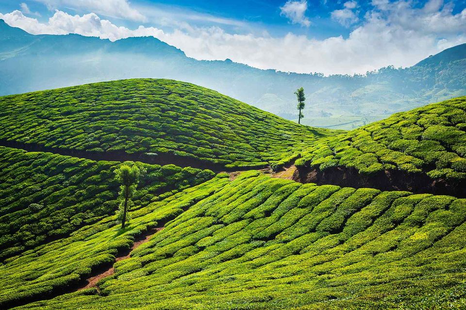
Munnar is one of the well known hill stations in India. It is located in the midst of the southern Western Ghats range in the state of Kerala. Munnar is a well known place for tourism and is also known for tea and coffee plantations. Hundreds of people come to the Munnar to get a feel of the idyllic climate. Munnar in Kerala is surrounded by sprawling vegetation of tropical and semi tropical trees. The entire town is surrounded by waterfalls and lovely mountains. The Mattupetty Dam is also at an easy distance. The town is spread over an area of 557 square kms. The climate of Munnar, Kerala is mild and pleasant. The ideal time to go for trips to the town is between the months of October and March.

2. Meesapulimala

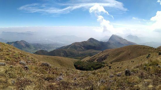
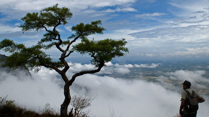
Meesapulimala Peak trek is a trek through lush green valleys, hundreds of blooming Rhododendrons, charming tea estates, gurgling brooks – peace is easy to find in the idyllic surroundings of Meesapulimala. Located at a significant altitude of 8,661 feet in the Idukki district of Kerala, Meesapulimala is a trek through eight hills, passing through the shared border of Tamil Nadu and Kerala.One of the Best part of the Meesapulimala Trek you could see lots of Rhododendrons flowers. The Valley is also called Rhodo Valley. It’s special because it is the only place where you see these flowers in south India else it grows in abundance in Sikkim and nearby regions. Rhododendron trees are actually the state tree of Sikkim. Please do look for the picture of this beautiful flower tree.

3. Agastya Mala

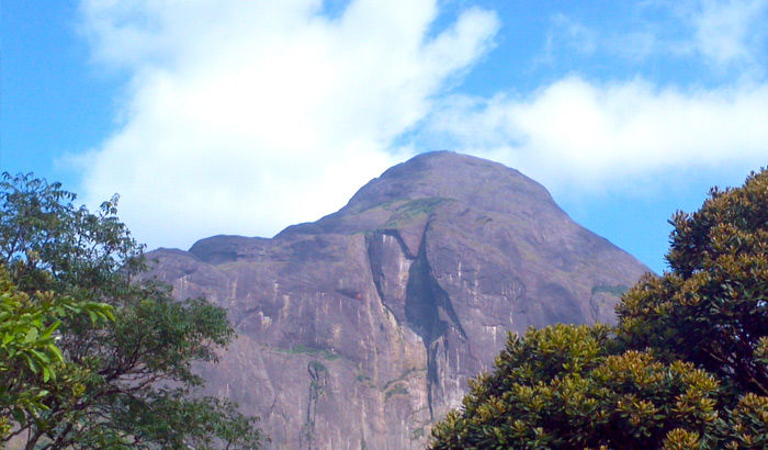
Agasthyakoodam (also known as Agasthyarkoodam) is a 1868m tall mountain within the Neyyar Wildlife Sanctuary in Thiruvananthapuram district, Kerala. It lies on the border between Kerala and Tamilnadu. It is also known as Agasthyamala in Malayalam and Pothigai Malai in Tamil. This mountain belongs to the Ashambu Hills, the southern end of Western Ghats. There are over 25 peaks in Ashambu Hills and Agasthyakoodam peak is the tallest one among them. The forests around this peak are famous for the abundance of rare medicinal herbs and plants. It is also far away from human settlements, making it one of the pristine natural forests in Kerala.

4.Ponmudi

Ponmudi is a beautiful and calm hill destination and it is surrounded by fresh and green environs making it an ideal holiday getaway. You are bound to get allured by its lush flora and fresh atmosphere. This hill station is at a driving distance from the capital of Kerala and the journey is filled with thick tropical forests and steep climb and mist covered hill ranges. Ponmudi is divided into the upper and the lower retreat putting more focus on the upper area for ecotourism project. And it is here you will find an assortment of mountain wildflowers, unique butterflies and small rivers, all this makes Ponmudi an attractive and small hill paradise to venture when in Kerala.

5.Vagamon

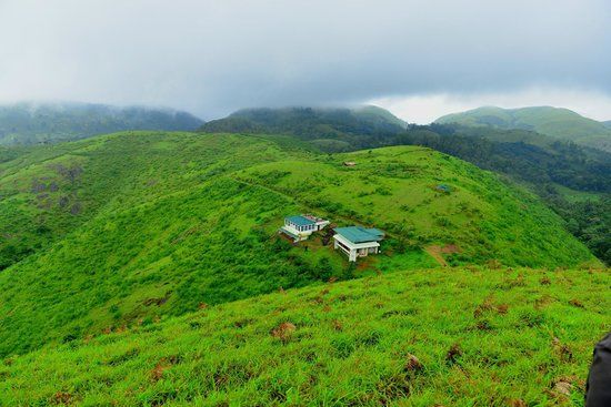
Vagamon hill station in Idukki is among the few spots on the planet that need to be experienced first-hand to truly discover its glory. The grassy hills, velvet lawns and overall mysticism of the place cannot be replicated anywhere else in the world. This quaint town lies untouched by any modern influences and is neatly tucked away in Idukki district. Visitors can avail many activities including trekking, paragliding, mountaineering and rock climbing. People love travelling across a chain of three famous hills: Thangal, Murugan and Kurisumala. These are important to Hindus, Muslims and Christians, respectively, and are a perfect example of the communal harmony prevalent in the place. The Kurisumala monks have an enchanting dairy farm nearby that is an absolute delight to visit.

6. Chembra Peak

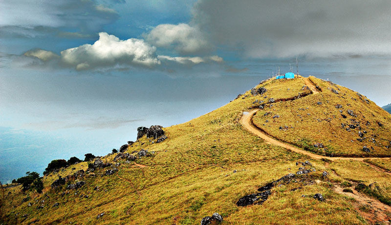
hembra is the highest peak in Wayanad district and lives up to its billing of being a picturesque location. It has managed to maintain its pristine nature over the years. Situated 2100 m above sea level, this peak offers a breath-taking view of rare flora and fauna. One can come across many exotic species in these parts. The route to the peak itself has a brilliant view along with a heart shaped lake, waterfalls and lush greenery the whole way. It is a prime spot for trekking but prior permission needs to be taken before going on these treks. Guided tours are available and can help in enhancing the entire experience.

7.Nelliampathi

Nelliyampathy is a virgin hill station located in Palakkad district of Kerala. Nelliyampathy is blessed with lush dense rain-forests with number of wild animals like elephants, hill squirrels, deers and bison. Located above 467 m above sea-level, it is well known for its sprawling tea gardens, coffee, cardamom and orange plantations. The largest perennial multi crop organic farm in the world owned by Poabs-India has given this sleepy hill station, international repute. Several small waterfalls, streams and rocky hill ranges also add beauty to this wonderful summer destination.

8.Vythiri

Vythiri, a beautiful locale in Wayanad, is famous for its spice plantations, beautiful forests and the diverse traditions of its tribal communities. It is among the best picnic spots in the entire State. The evergreen forest surrounding Pookot Lake is a thing of beauty. Kayaking, pedal boating and row boating, a freshwater aquarium, children’s park, and a handicrafts and spices emporium are among the main tourist attractions available here. 8km from Vythiri is this hidden retreat that is slowly gaining traction with visitors. You can avail boating and angling options or relax at the Recreational Park here. People love trekking to this spot as well.

9. Silent Valley

Silent Valley National Park is one of the most ecologically diverse areas on the planet with some flora and fauna which are found nowhere else in the world. Visit to get an opportunity to see over 34 species of mammals amongst which are the rare lion-tailed macaque, Nilgiri langur, Malabar giant squirrel and hairy-winged bat. Entry into the valley is allowed only from 8 am to 2 pm. Special permission is required to enter which can be obtained on the spot at the Forest Department office at Mukkali. You can rent a Jeep from Mukkali to the Valley for Rs 650.

10.Ranipuram

The gentle hills of Ranipuram in Kerala are famous for its trekking trail. Situated at the height of about 750 meters above sea level, this destination has thick forest vegetation and lush green grasslands. The whole place is proposed inside the Ranipuram Wildlife Sanctuary which merges with Talakaveri Wildlife Sanctuary of Karnataka. The sublime beauty of this region is comparable to that of Ooty, and is a must visit for all nature enthusiasts. The innocent life of the village and gentle nature make a perfect blend of delight and enjoyment.

Friday, 22 February 2019

HEAVENLY KOLUKKUMALAI


Kolukkumalai is the world’s highest organic tea plantation which is located about 8000ft above the sea level. The off-road Journey towards the top of Kolukkumalai is adventurous one. Tourists can hire jeep from suryanelli where government authorized jeeps are available which cost around Rs2000 for one jeep. The tea estate is the private property of Harrison Malayalam ltd. They are India's largest producer of rubber and also south India's largest cultivator of Tea. 


The sunrise beauty of kolukkumali should experience once in your lifetime. To experience that one need to catch early morning jeep service which starts around 4`O’ clock. It takes 2 hours to reach the top of the hill through the bumpy off-road. It is better for pregnant women and people with back pain should not avail this trip. Nilgiri Tahrs, which are found only in the Western Ghats can be spotted in Kolukkumalai. The local jeep drivers are very friendly and explain every minute scenes throughout the journey.


The first attraction before the hill top view was the Tea Factory which is built by the British during 1900s.The entry fee to visit the old tea factory is Rs 100 per person. They explain the process of tea manufacturing in a detailed way. The factory does not have any modern machine or computerized systems and they are date back to the 1940s. The jeep will stop at a parking point and one need walk about 500mtrs to reach the top of the hill station. The peak gives a beautiful view of both Tamil Nadu and Kerala. It borders Kerala and Tamilnadu.


The mind-blowing scenic views on the top of kolukkumalai is heavenly one. It is very beautiful site to watch the mist suddenly cover and uncover the huge peak. Meesapulimala, the second largest peak in Western Ghats is also visible from Kolukkumalai. Be aware of the blood drinking leeches hiding over the small bushes and plants on the peak. It is very difficult to take them out if it bite us. Neelakurinji which is blooming once in 12 years will cover all over the hills when its season starts. But the non-responsible tourists are plucking the flower and spoiling the beauty of the nature. It’s better to carry eatables and necessary drinking water because it takes 4 hours to visit and return back to suryanelli. Best time to visit is  from November to March.

Tuesday, 12 February 2019

Unexplored Heavens of Idukki, Kattadikadavu, Anachadikuthu, Meenuliyanpara

A journey through the unexplored heavens of Idukki.

       Traveling leaves one speechless, turns him or her into a storyteller, and takes one into the unexplored lands. We planned our travel to that kind of some unexplored heavens of Western Ghats. At early morning we packed our bags and start our journey to our first attraction Kattadikadavu. Kattadikadavu is an emerging attraction which is located in Vannappuram panchayat of Idukki District. Kattadikadavu offers an enchanting panoramic experience to the tourists. The journey to Kattadikadavu offers a great riding experience with sharp hairpin curves and great scenery. Kattadikadavu is less crowded and less explored by the tourists. There is a shop at the entry point of Kattadikadavu which offers local foods and drinks.


       Before starting trek, keep your vehicle in the bottom of the main road and must carry water because trekking to the top of the hill station is too much challenging. One need to walk about 2 KM to reach the top of the hill station. Kattadikadavu can be called as a virgin beauty because the land is not exploited by tourists. The cold brezze in the top of the hill station will wake up your five senses. Hilltop offers long view of kochi refinery and also the nearby attractions like Meenuliyanpara and Thommankuthu.


After experiencing the virgin beauty of western ghats we proceed our jouney to Aanayadi Kuthu. Aanayadi kuthu which is also called Aanachadi kuthu which is located in the border of Vannapuram and Karimannur panchayat of Idukki district. The place is known as Aanachadi Kuthu because decades ago elephants are used to came near the waterfalls to drink water and once an elephant is slip into the water and died. We kept our bikes in a rubber plantation and start walking. The concerned authority made concrete bridges to cross the streams. The brook of the waterfall is spread over the rubber plantation. Finally we reached the waterfall and got excited and start roaring because it was that much beautiful. We jumped into the waterfalls and enjoyed the nature with atmost happiness. We played a lot in water and saw some small creatures living in water. The sad thing i noticed is that some tourists thrown plastic bottles near the waterfalls. That kind of irresponsible activites may damage the beauty of this beautiful waterfal. After enjoying the less explored beauty of Idukki we had our lunch and proceed our journey to Meenuliyanpara.


      Meenuliyanpara is a beautiful mountain peak which is situated at a distance of 36 kms from Thodupuzha in the Vannappuram panchayat of Idukki District. The surface of this huge rock mountain looks like fish scales and hence the mountain gets the name ‘ Meenuliyanpara’. The road to Meenuliyanpara was too difficult due to the recent landslides and flood that happend in Kerala. We trek about 2-3 kilometers through the rocks which spread over more than 500 acres. We forget to buy water so that we drink the water from the rocks. Water from the rocks bring us a great refereshment that any soft drinks can give. It gave us more power to trek over the top of the hill station. The top of the hill station is a different world. The majestic beauty of the western ghats can be well enjoyed at the top of the hill station. There is a small forest area at the top of the hillock with tall trees and branches. Small wild animals like snakes, hares, mongoose, monitor lizards etc inhabits the region. Trekking through the forest offers you soul – soothing sights of wild streams glittering in the rays of light that burst through the forest. There is also a flat piece of rock that stands vertically in the middle of the forest. Visitors will get surprised to see the image of a five-headed snake in this piece of rock, and for this reason the forest is sometimes called as ‘Abode of Snakes’. The distant view of Lower Periyar, Bhoothathankettu can also be see in the top of the hillstation. The breathtaking views from the top of hill station is already attracting attention but still the place remains relatively unknown. During our trip the strange element happend is that there was no visitors other than us in all the attractions we visited. After the trip we returned to Mahatma Gandhi University with lot of happiness because the three attractions bring us a great chance to experience the nature.